Try It at :https://cegs-project.kmitl.ac.th/rapis/
🚀 What We Do
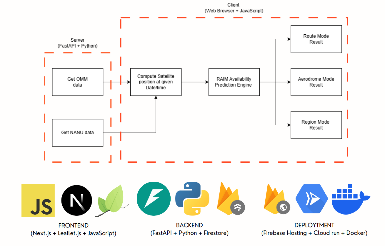
RAPiS (RAIM Availability Prediction System) is a specialized platform designed for aviation safety. Using Orbital Mean-elements Message (OMM) orbital data, we predict GNSS satellite positions along flight routes between airports, assess RAIM (Receiver Autonomous Integrity Monitoring) availability, and visualize signal jamming threats – all to ensure safer flight planning.
✨ Key Features
- Flight Route Intelligence: Calculate GNSS satellite positions along specific flight paths between airports.
- Airport Analysis: Predict satellite visibility and integrity monitoring availability at airport terminals.
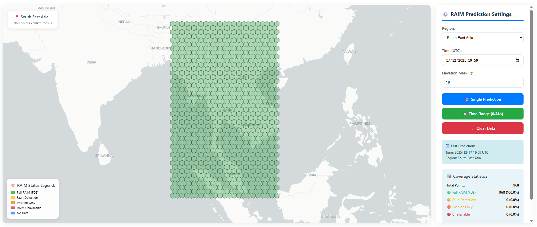
- Interactive Heatmaps: Visualize satellite coverage and signal availability in a region or worldwide.
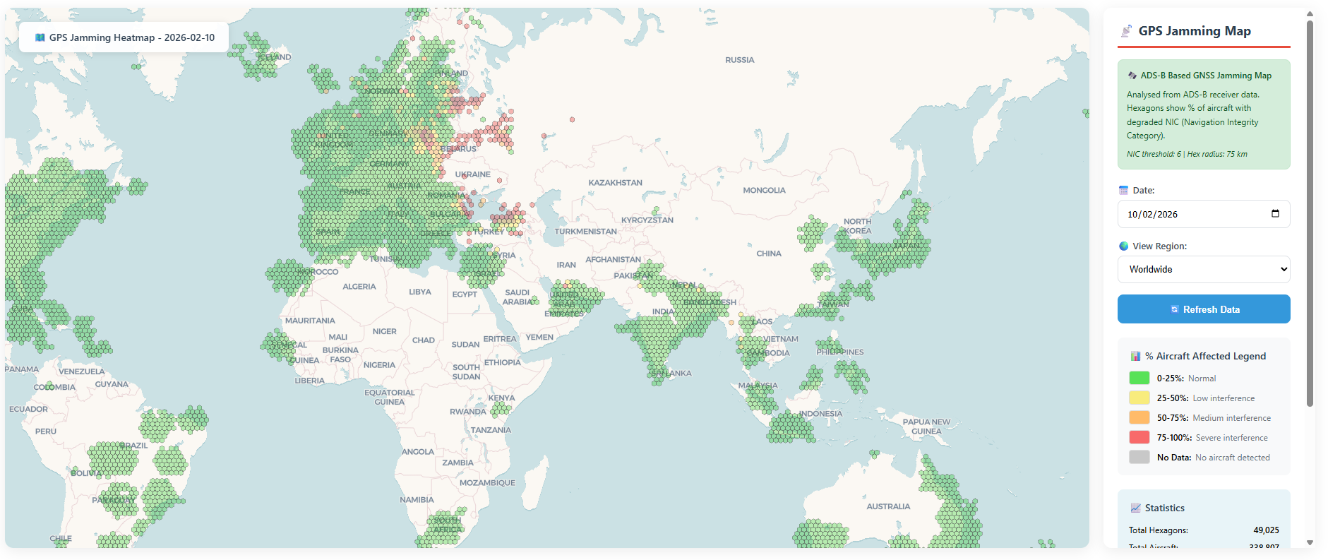
- GPS Jamming Map: Monitor potential GPS signal disruptions and threats.
🎯 Why It Matters
Modern aviation relies on GNSS for navigation, but satellite availability isn’t guaranteed. Signal jamming, satellite geometry, and coverage gaps can create unsafe navigation conditions. Our platform helps aviation professionals identify these risks before takeoff, enabling safer route planning and contingency preparation.
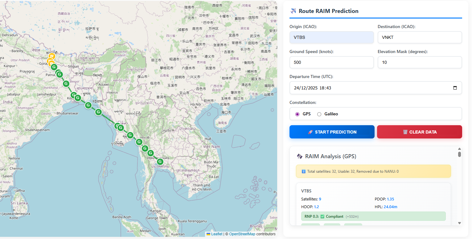
Route Mode
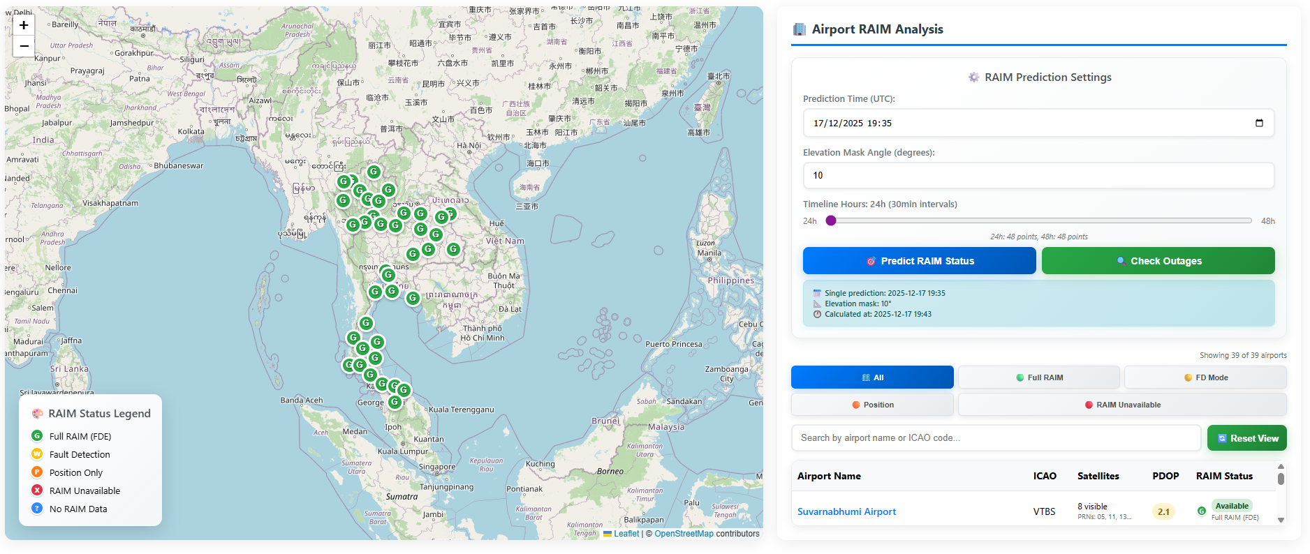
Aerodrome Mode
Region Mode
GNSS Jamming Map
Our Team
Kantapon K.

Thongchai P.

Teerachai S.

Awards
Thailand New Gen Inventors Award
(I-NEW GEN Award )2026
2nd Runner-Up & Gold Medal (Higher Education)
Issuer: National Research Council of Thailand (NRCT)